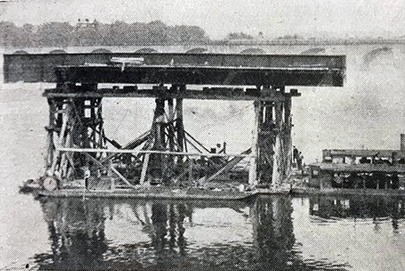
The original east channel girders being floated to the western channel. Photo courtesy of Modjeski and Masters.
Bicycling across the Market Street Bridge, you may have noticed that the eastern span is several feet higher than the western span. That wasn’t always the case. The existing Market Street Bridge was originally built in 1905 as a two-lane bridge to replace the wooden Camelback Bridge, built in 1890, but destroyed by a flood in 1902. The current structure is the result of a project to widen the bridge to four lanes in 1926. The then fairly new engineering firm of Modjeski and Masters found an ingenious way to keep traffic flowing while adding two additional lanes for traffic. The original stone arch piers that support the bridge’s western span were supplemented to support two additional lanes of traffic. Because of the Susquehanna’s propensity to flood, higher piers were built to support new lanes for the eastern span. Once traffic was able to use the new eastern span, the girders for the old eastern span were floated across the river to make the western span four lanes wide.
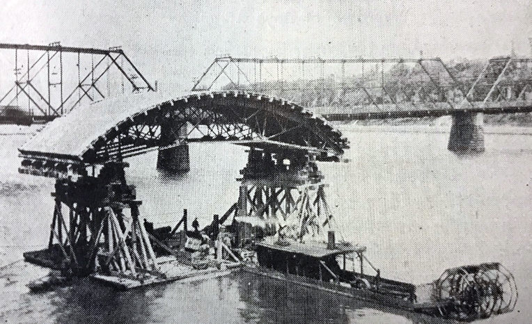
The floating forms used to create the east channel spans. Photo courtesy of Modjeski and Masters.
The existing eastern piers were supplemented and raised to bring them to the level of the new piers, then the roadway and sidewalks were added. Modjeski and Masters contracted with Paul Philippe Cret, a renowned architect and partner on many bridge designs, to help complete aesthetic elements of the design. His work resulted in the entry plaza on the bridge’s east end which includes pillars from the front of the old Capitol building which burned in 1897. The newly completed bridge opened on April 25, 1928.
PennDOT has announced plans to greatly modify the bridge in the near future. Currently, utilities (like electric lines) are under the downstream side sidewalks and accessible under metal plates. A new utility bridge is planned which will include a 14-foot wide bicycle/pedestrian lane. The bridge’s downstream sidewalks will be removed while the upstream sidewalks will be replaced. The bridge’s lanes will become a uniform 10 feet wide with narrow shoulders on both the upstream and downstream sides. A separate project is also planned to improve the area at the west end of the bridge, known as the “Lemoyne Bottleneck,” making it safer for motorists, pedestrians, and cyclists.
Did you enjoy this article? Consider donating to our Buckle the Belt fundraiser.